Land & Building
Surveys
Established in 2002, Robotic Surveys Limited provides accurate measured survey data for Architects, Planning Consultants, Consulting Engineers & the construction industry in general.
We specialise in providing small & large scale 2D & 3D topographical, measured building & drone surveys. Our lead-in time following your initial enquiry can be as little as 3 days & depending on the size of the project, the survey delierables can be returned to you within one week.
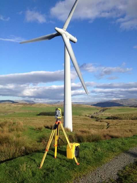
We utilise the latest Trimble technology including Robotic Total Stations, Global Positioning Systems(GPS), 3D Laser Scanning & UAV Drone equipment
Survey instruments are serviced & calibrated annually to the manufacturers specifications and all work is covered by our Professional Indemnity & Public Liability Insurance
Our coverage is nationwide & our rates competitive, please contact us for a quote.
01
Topographical Surveys
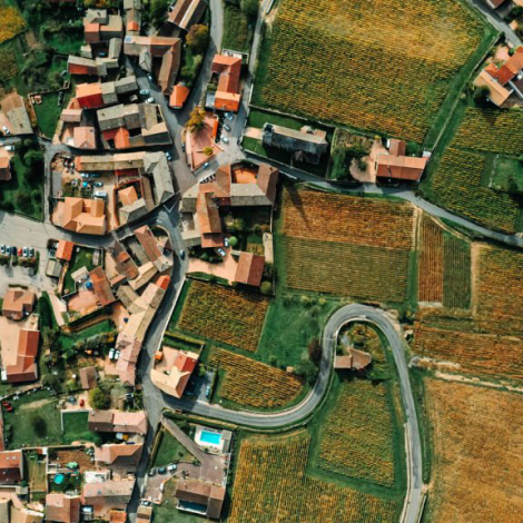
A topographical survey is the starting point in the planning & execution of most types of construction, from transport & communication, mapping to new buildings & development. We carry out full & detailed surveys of greenfield, brownfield, urban & industrial sites. Surveys are carried out to a scale of your choice with all features accurately labelled & a grid of levels to accurately model the survey area. Survey data is output to 2D & 3D Autocad dxf/dwg, MOSS & XYZ files & we still even print on paper!
02
Measured Building Surveys
Detailed measured building surveys from small residential properties to large scale industrial premises, heritage sites, derelict structures & agricultual buildings. Survey data is converted into accurate 2D plans in the form of elevations, floor plans, sections, roof plans & reflected ceiling plans Our drone also provides imagery to help record data within inaccessable areas.
03
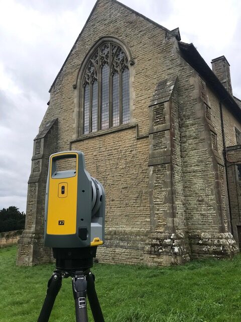
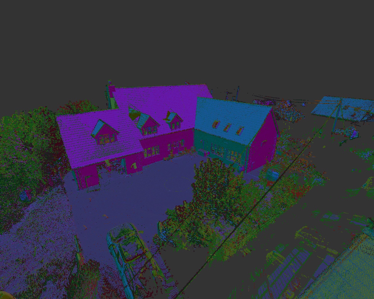
3D Laser Scanning
3D laser scanning or LIDAR(Light Detection & Ranging) uses a beam of light to reflect off a surface/structure which is returned to a camera in the scanner convering it to 3D dimensional points. This is exported to a 3D Model & ‘point cloud’ containing millions of data points/measurements, the benefits of which include:-
- Fast measurements & less time on site
- The ability to add data at a later stage of a project.
- Can measure structures where access is restrited & difficult/dangerous

04
UAV/Drone Surveys
Drone surveys enable unlimited access to allow roof, chimney & window inspections. Using the lastest DJI drones, we can provide high quality aerial photo & video images eliminating the need for costly access equipment & time consuming H&S procedures.
05
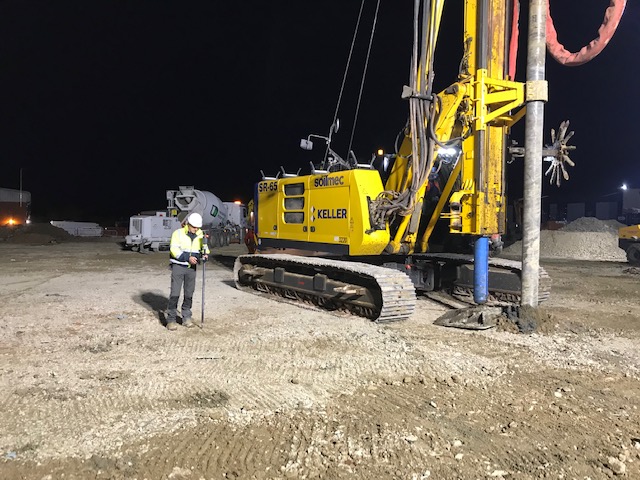
Piling setting-out
We have vast experience in the setting-out of pile positions on all types of construction project including houses, industrial units, schools, hospitals, offices & sports stadiums. Positions are marked out to tight tolerances, pinned & capped. Records are provided to show setting-out accuracy and ‘As-Built’ surveys undertaken to record pile centres and there subsequent deviation from the designed point.
06
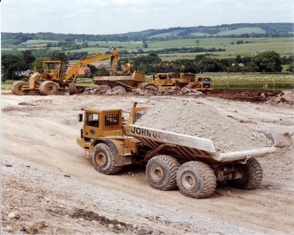
Earthwork measurement & volumetric surveys
Complete & up-to-date measurement of any type of earthworks project, including landfill sites, quarries, roadworks, bunds & stockpiles. Accurate volumes using Digital Terrain Modelling(D.T.M) substantiated with cross-sectional area sections
07
Boundary Surveys
If you are adjusting your property boundary to create a new ‘parcel’ of land, we can visit site, accurately measure the plot & produce a ‘Land Registry Compliant Plan’ for submission & registration.

08
Other Services
GPS surveys
‘As-Built surveys
Landscaping suveys
Accurate measured survey data for Architects, Planning Consultants, Consulting Engineers & the construction industry